Middle Yampa Segment – Sediment Transport & Continuity Score 2022

Ecological Health & Function

CATEGORY: Sediment Regime

Score coming 2025
Score coming 2026
Score coming 2027
Listen to the excellent description in the video below about how rivers carry the water, sediment, debris, and energy that shape our landscape.
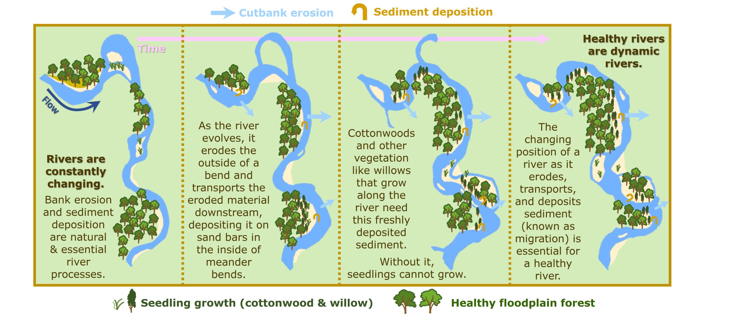
Rivers are shaped and formed by erosion and deposition. As a river erodes in one area, it also deposits sediment in another, leading to the mosaic of landforms commonly seen along rivers.
Naturally functioning and healthy rivers are not static, but move throughout the landscape, creating fresh, nutrient-rich surfaces and removing older ones. Think of a river bend in a meandering river — as it moves outward one direction, eroding its banks, it deposits sediment on the inside of the bend, creating new land. Often, we enjoy sitting on these gravel or sandbars that the river leaves behind as it moves. This circuit of events — of creation and destruction — is essential for the health of the ecosystem that surrounds the river.
Cottonwood and willow, for example, require newly created land in the form of fresh sandbars to successfully reproduce. If rivers cannot move, if they are hemmed in and frozen in place by human impact, then this dynamic sequence is stopped, and the vegetation that surrounds the river may grow old and die.
Damaging erosion that results in significant land loss may occur during extreme flooding events or downstream of reservoirs where the released water is not carrying its normal sediment load. Healthy riparian forests help to buffer this type of erosion, as does the ability for a river to flood its banks and thus reduce its energy and capacity for extreme erosion.
