How it Works

The Yampa Basin is divided up into 6 segments

- Upper Yampa Segment
- Steamboat Segment
- Elk River Segment
- Middle Yampa Segment
- Lower Yampa Segment
- Dinosaur Segment
Each segment is further divided into “riverscapes,” or channel/floodplain lengths that are geomorphically similar. Upon assigning scores for each indicator within each riverscape, the category scores are “rolled up” to calculate final attribute scores for each riverscape. Riverscape scores are similarly rolled up to determine overall segment scores.
Click through the tabs below for segment information.
Upper Yampa Segment
Steamboat Segment
Elk River Segment
Middle Yampa Segment
Lower Yampa Segment
Dinosaur Segment
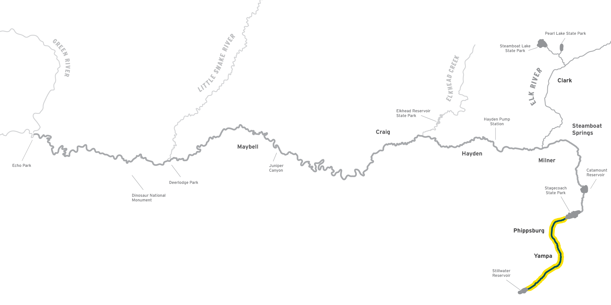
The Steamboat segment begins at the tailwaters of the Upper Yampa Water Conservancy District’s Stagecoach Reservoir and ends at the Xcel Pump Station (sometimes referred to as Pumphouse), a Colorado Parks and Wildlife (CPW) public river access site approximately 5 miles east of Hayden. It was scored in 2023.
The segment flows through the Sarvis Creek State Wildlife Area, Pleasant Valley, privately-owned Lake Catamount, CPW’s Chuck Lewis State Wildlife Area, the City of Steamboat Springs, the Elk River confluence, the unincorporated community of Milner, and a portion of The Nature Conservancy’s Yampa River Preserve. YRSP analyses do not include Stagecoach Reservoir or Lake Catamount.
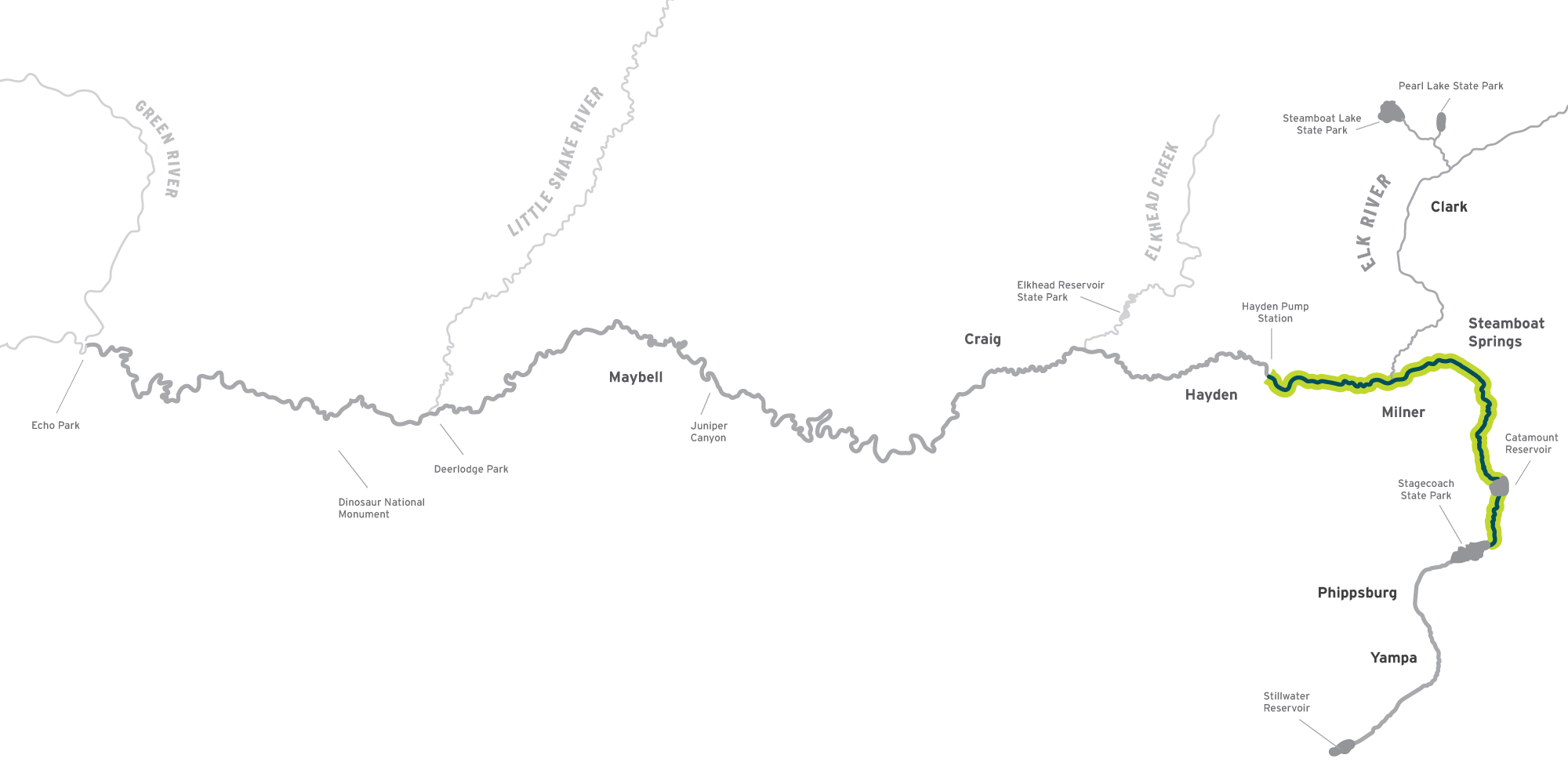
The Elk River segment begins at the confluence with the South Fork Elk River downstream of the Mount Zirkel Wilderness and ends at the confluence with the Yampa River just east of Milner. The segment follows the Elk River through a mixture of private property and the Medicine Bow-Routt National Forest, past the small hamlets of Glen Eden and Clark, and through a combination of large working ranches and small private developments. The Elk River segment also passes through the Christina State Wildlife Area (a Colorado Parks and Wildlife fishing easement) before it connects with the main stem Yampa River about 3 miles east of Milner. This segment was assessed in 2025.
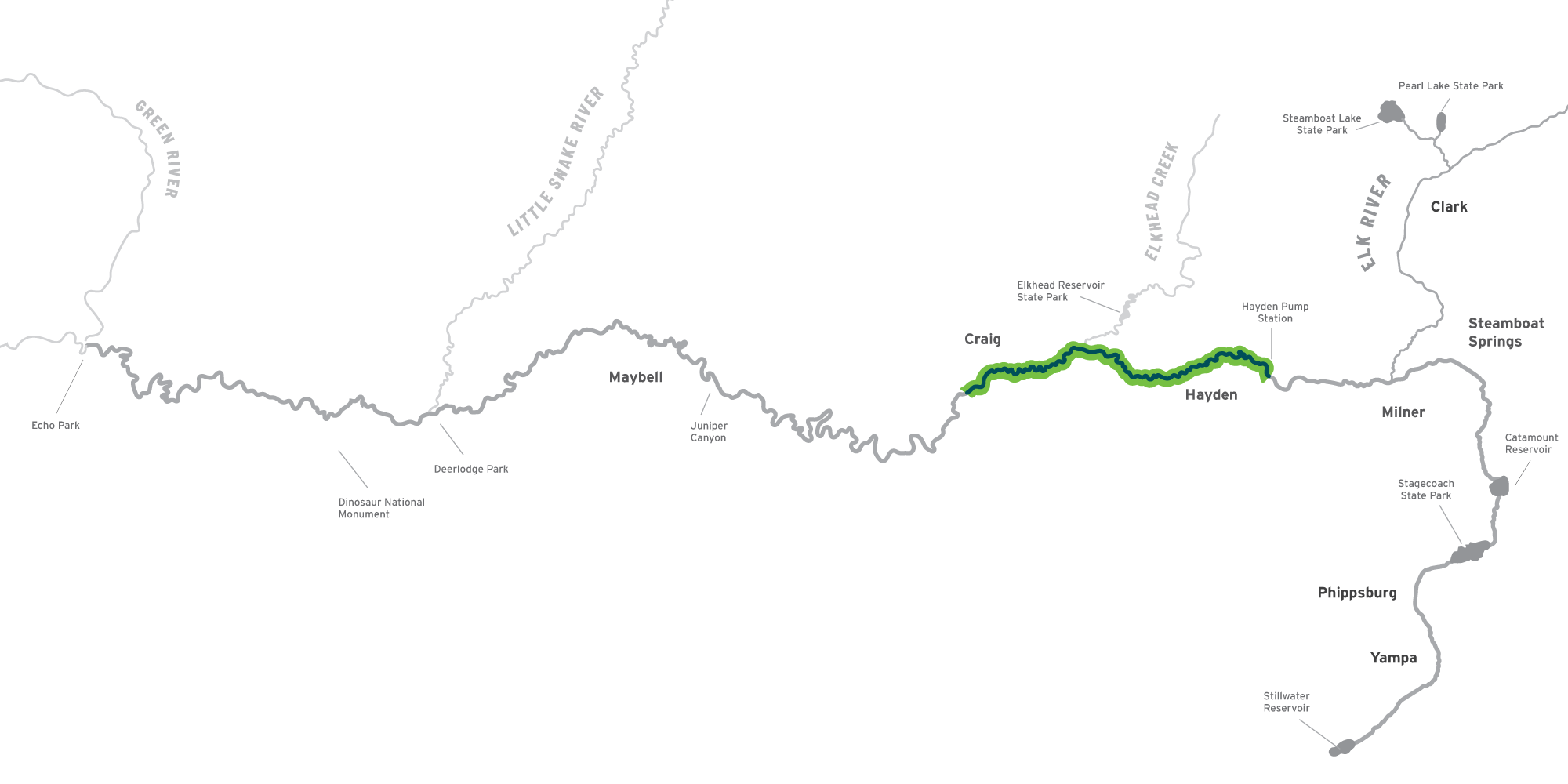
The Middle Yampa Segment is a 39-mile section of river spanning from the Hayden Pump Station, a public river access site approximately 5 miles east of Hayden, to South Beach, a public river access site located approximately 3 miles south of Craig, was identified as the initial focal segment for the Yampa River Scorecard Project. This section of river is referred to as the Middle Yampa Segment and was scored in 2022.
The Middle Yampa Segment flows through Morgan Bottom, the Town of Hayden, Yampa River State Park Headquarters, the Yampa River State Wildlife Area (Dorsey), the city of Craig, the Yampa Valley Golf Course (Pebble Beach), and Moffat County’s Loudy-Simpson Park.
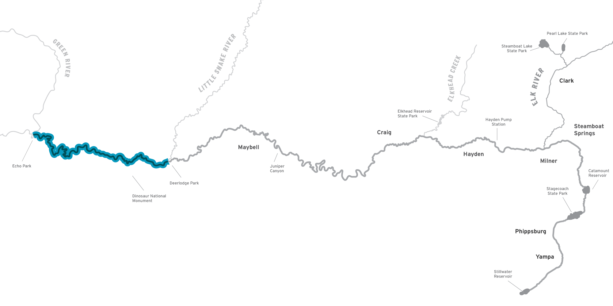
The Lower Segment runs from South Beach access point just outside of Craig to Deerlodge Park near the Colorado/Utah border.
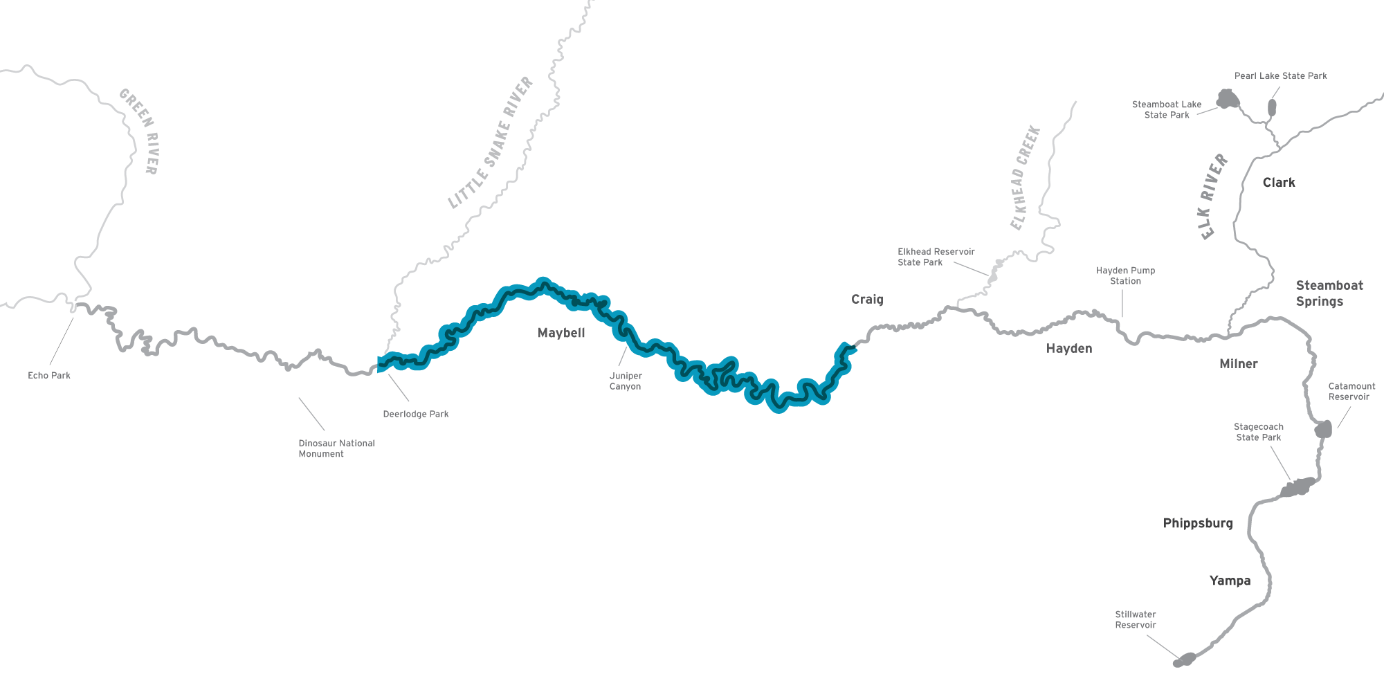
The Dinosaur segment extends from the confluence with the Little Snake River near Deerlodge Park, flows through Dinosaur National Monument, and ends at the Yampa’s confluence with the Green River at Echo Park. This segment will be assessed in 2026.
Scoring Scale
All scores are based on the general criteria below.

OPTIMAL & FULLY FUNCTIONAL self-sustaining with minimal/no management, thriving


FUNCTIONAL while basic functions are intact, stressors impair the system; frequent management is needed to maintain long-term viability


NON-FUNCTIONAL biologically unsuitable
