Attribute
Ecological Health & Function
Ecological Health & Function Categories
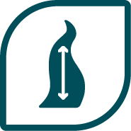
Flow Regime
Sediment Regime
Water Quality
Habitat Connectivity
Riverscape Connectivity
Riparian Condition
River Form
Structural Complexity
Biotic Community

Flow Regime
Flow regime is defined as the characteristic pattern by which water is supplied to a river segment from its contributing watershed. It is often represented by a hydrograph, and is dictated by precipitation, weather patterns, watershed characteristics, and human influences. Flow regime is a primary determinant of a river’s structure and function. In particular, the magnitude, duration, frequency, and timing of river flow interact with the landscape to determine the functions that the river performs.
Indicators
*Tip: Click on the indicator names to learn more!
 Hydrograph Indicator
 Snowpack Indicator

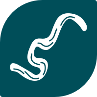
Sediment Regime
Sediment regime is defined as the amount and timing of sediment that all sources, including land erosion in the contributing watershed and upstream channel erosion, supply to a reach, as well as patterns of sediment transport along and out of a reach. The production, transport, and deposition of sediment largely determines channel form and dynamics. Like changes to flow regime, an altered sediment regime can cause significant impacts to stream form and function, including aquatic habitat quality and long-term channel stability, and can damage infrastructure.
Indicators
*Tip: Click on the indicator names to learn more!
 Sediment Transport and Continuity Indicator
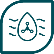
Water Quality
Water quality is defined as the quality of water in a river segment, and it is influenced by natural geological weathering, biogeochemical processes, and human activities (upstream land and water uses). Suitable water quality in streams supports recreational uses, ensures public health, and supports wildlife and fish habitat.
Indicators
*Tip: Click on the indicator names to learn more!
 Temperature
 Dissolved Oxygen
 pH
pH
 Macroinvertebrates
 Nutrients
 Metals

Habitat Connectivity
Habitat connectivity is defined as the interaction and interconnectedness between a river segment and its surrounding landscape, including pathways for movement of biological organisms and organic matter through the riparian corridor. This category includes connectivity of both terrestrial and aquatic communities, and considers both longitudinal (upstream/downstream) and lateral (channel/floodplain/upland) directions.
Indicators
*Tip: Click on the indicator names to learn more!
 Aquatic Connectivity Indicator
 Terrestrial Connectivity Indicator

Riverscape Connectivity
Riverscape connectivity is defined as the degree to which water can access and hydrate the surrounding riverscape (channel and floodplain). In particular, riverscape connectivity reflects the ability of the valley bottom to be actively and routinely engaged by fluvial processes. Connectivity varies naturally based on geology, topography, and hydrology. It also reflects impediments due to hydromodifications, channel modifications (e.g., enlargement, entrenchment, channelization/stabilization), and/or anthropogenic land uses within the floodplain (e.g., levees, drainage ditches, development, fill).
Indicators
*Tip: Click on the indicator names to learn more!
 Riverscape Connectivity Indicator

Riparian Condition
Riparian condition is defined as the degree to which riparian areas support river health and critical functions. Riparian areas, or lands that occur along and are influenced by waterways, provide many critical functions for maintaining healthy and resilient stream ecosystems, including providing physical roughness that slows water and mitigates the impacts of flood flows; increasing bank stability; hosting a diversity of riparian plants, animals, and microbes; shading the stream corridor to lower water temperatures; and much more.
Indicators
*Tip: Click on the indicator names to learn more!
 Vegetation Structure and Complexity Indicator
 Invasive Plant Species Indicator
River Form
River form is defined as the river channel shape and geometry. It is directly influenced by the physical attributes of the watershed (e.g., geology, topography, hydrology), channel hydraulics, sediment transport, and local hillslope and floodplain uses (e.g., adjacent roadways, grazing). Biological drivers (e.g., riparian vegetation, large woody material, beaver activity, aquatic vegetation) influence channel form as well, by altering hydraulics and erosional patterns.
Indicators
*Tip: Click on the indicator names to learn more!
 Channel Morphology Indicator

Structural Complexity
Structural complexity is defined as the degree of diversity and physical composition of a stream that results from interactions between flow regime, sediment dynamics, and other factors. The more complex and diverse the physical structure of a stream, the more enhanced the habitat for resident aquatic species. Structural complexity considers hydraulic characteristics (water depth and velocity patterns), bed and bank features, and substrate material.
Indicators
*Tip: Click on the indicator names to learn more!
 Macrohabitat Indicator
 Microhabitat Indicator

Biotic Community
Biotic community is defined as the health of resident aquatic biota including microbes, periphyton (attached algae), macrophytes (aquatic plants), macroinvertebrates (aquatic insects), fish, amphibians, and any other organism that is part of the aquatic biological community for all or part of its life history.
Indicators
*Tip: Click on the indicator names to learn more!