
see the score breakdown
Select an attribute area and click a category icon to see the scores represented on the map below.
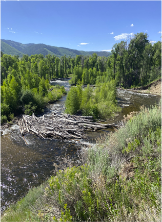
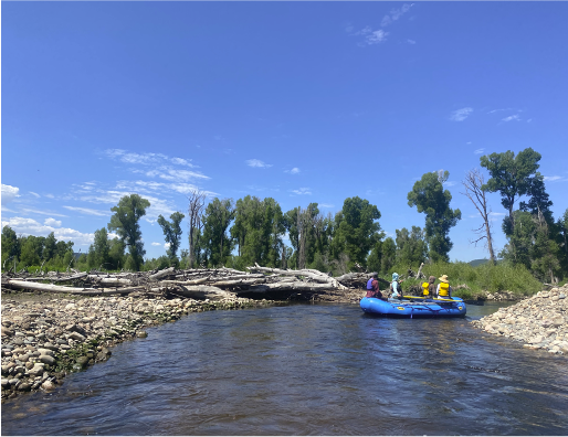
Select an attribute area:
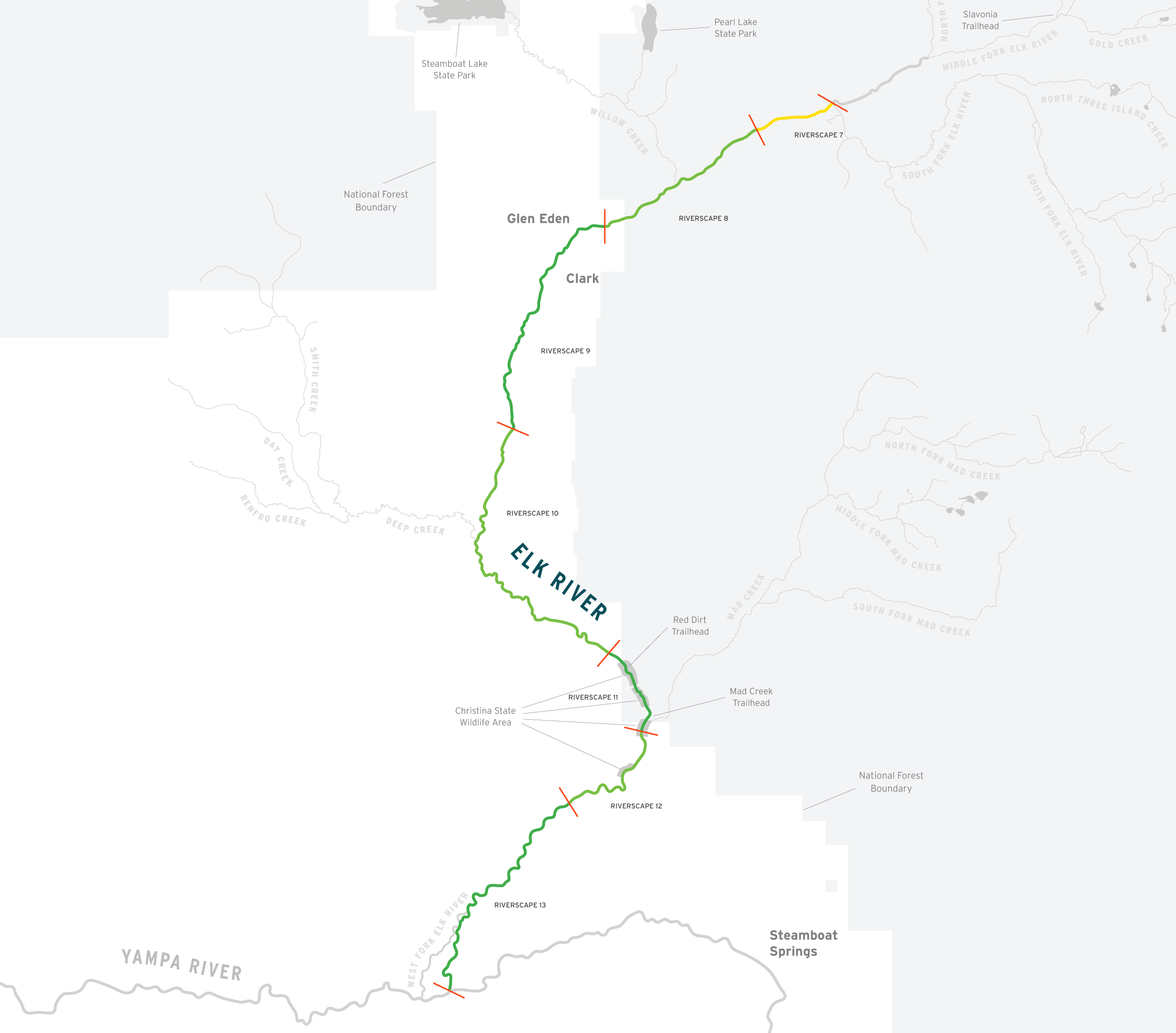
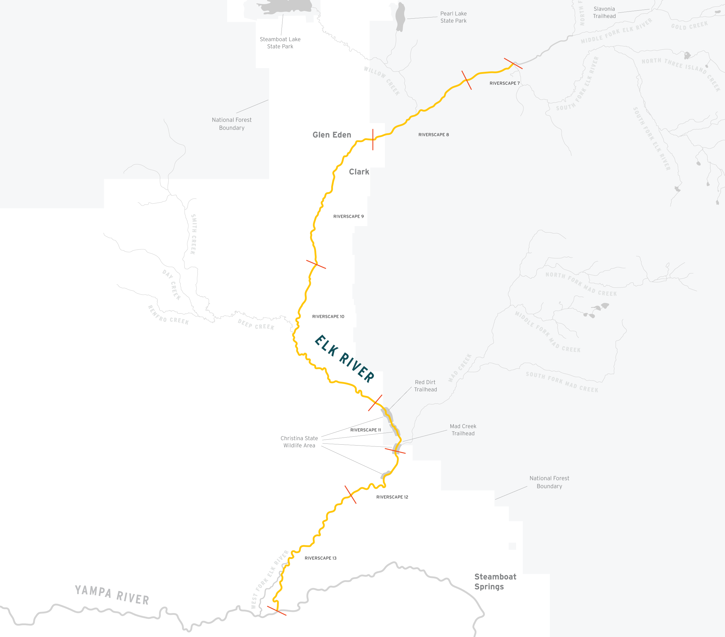
Category Score Displayed On Map:
Hydrograph:
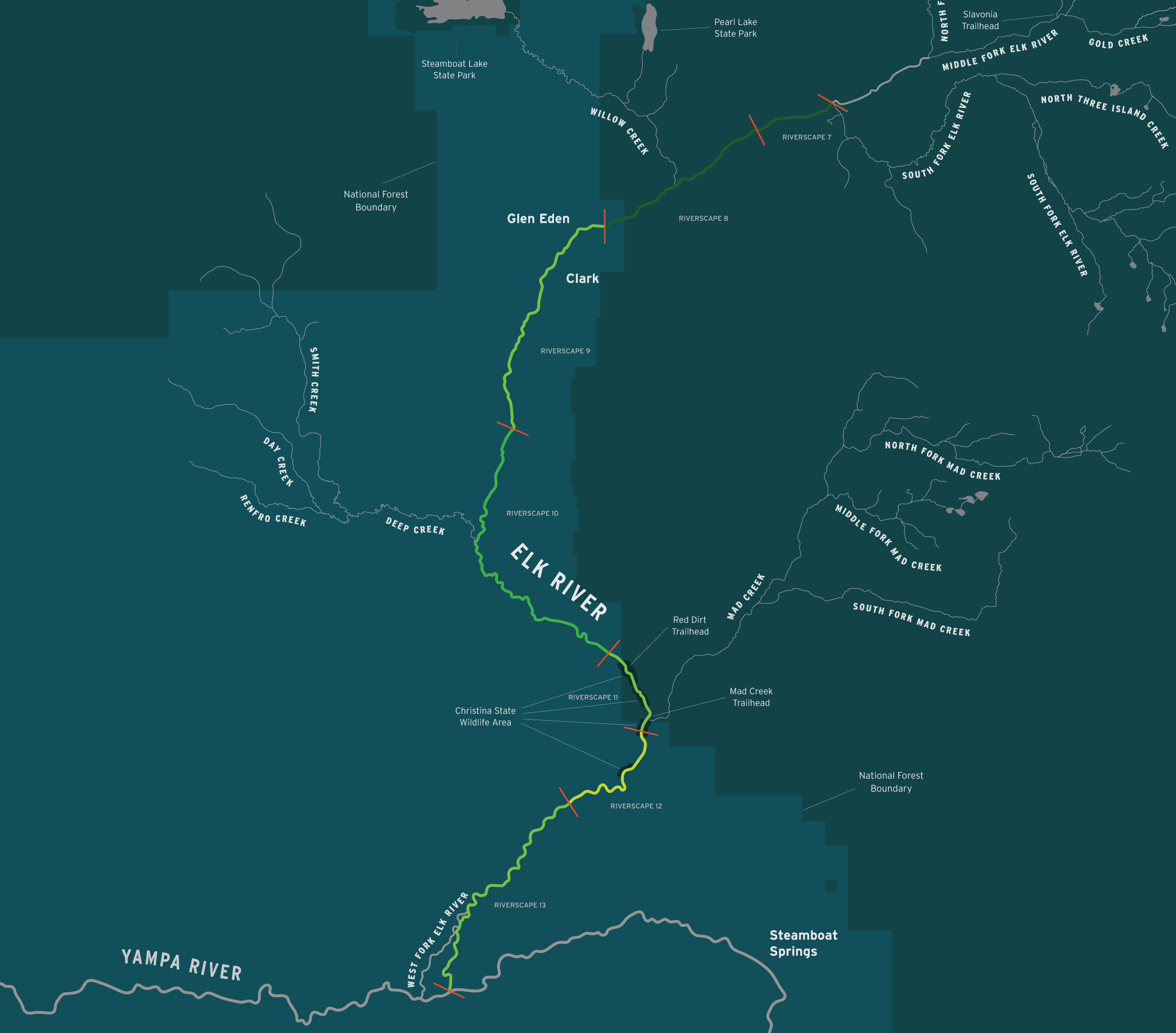
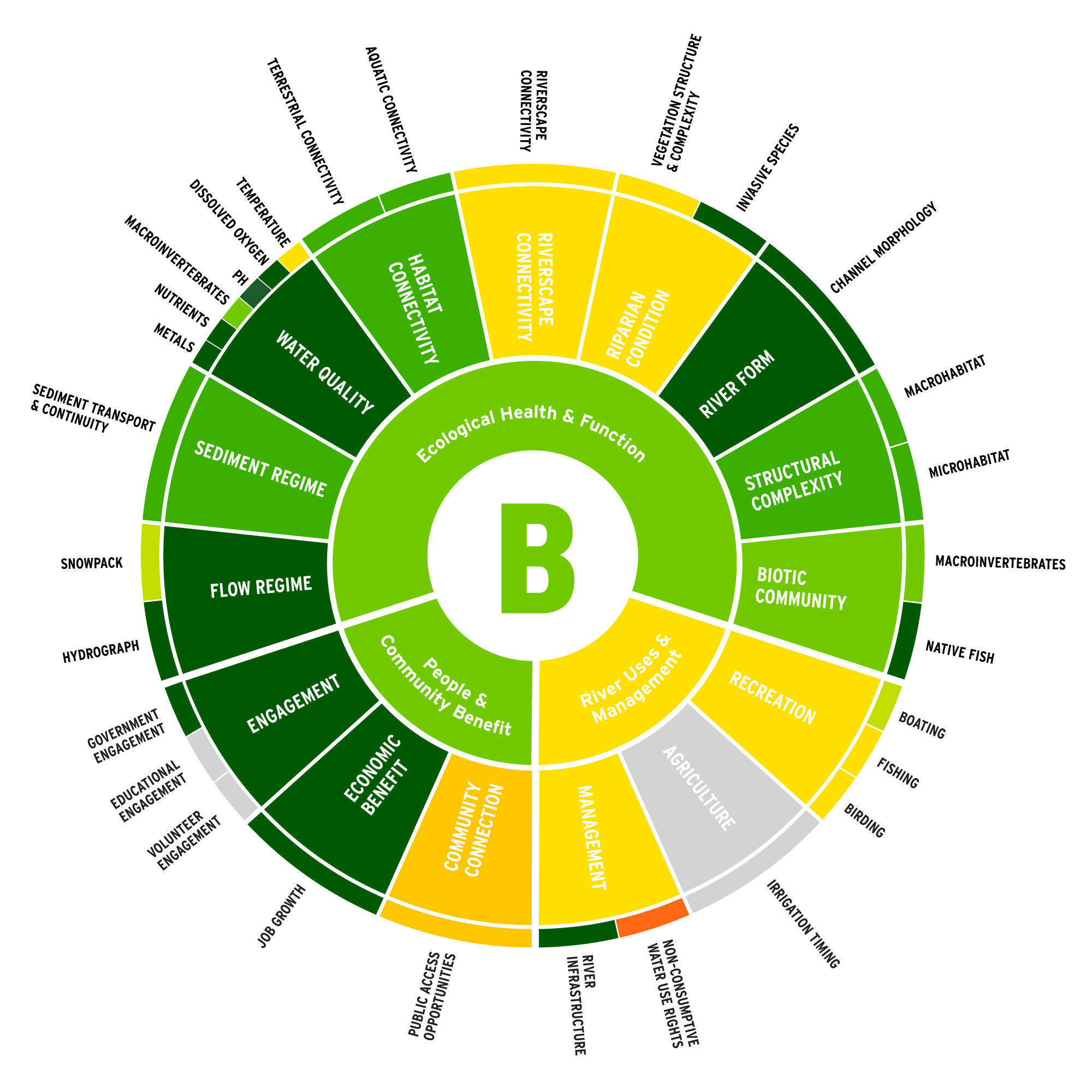
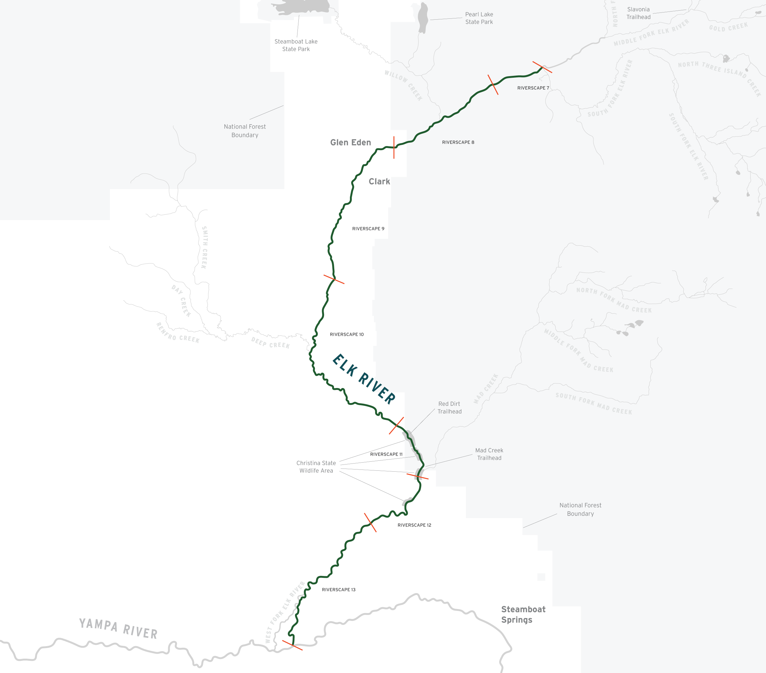
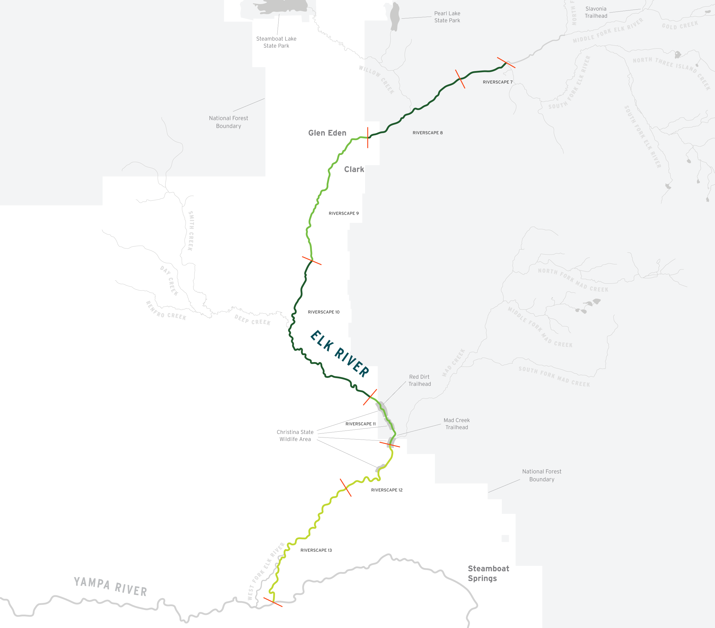
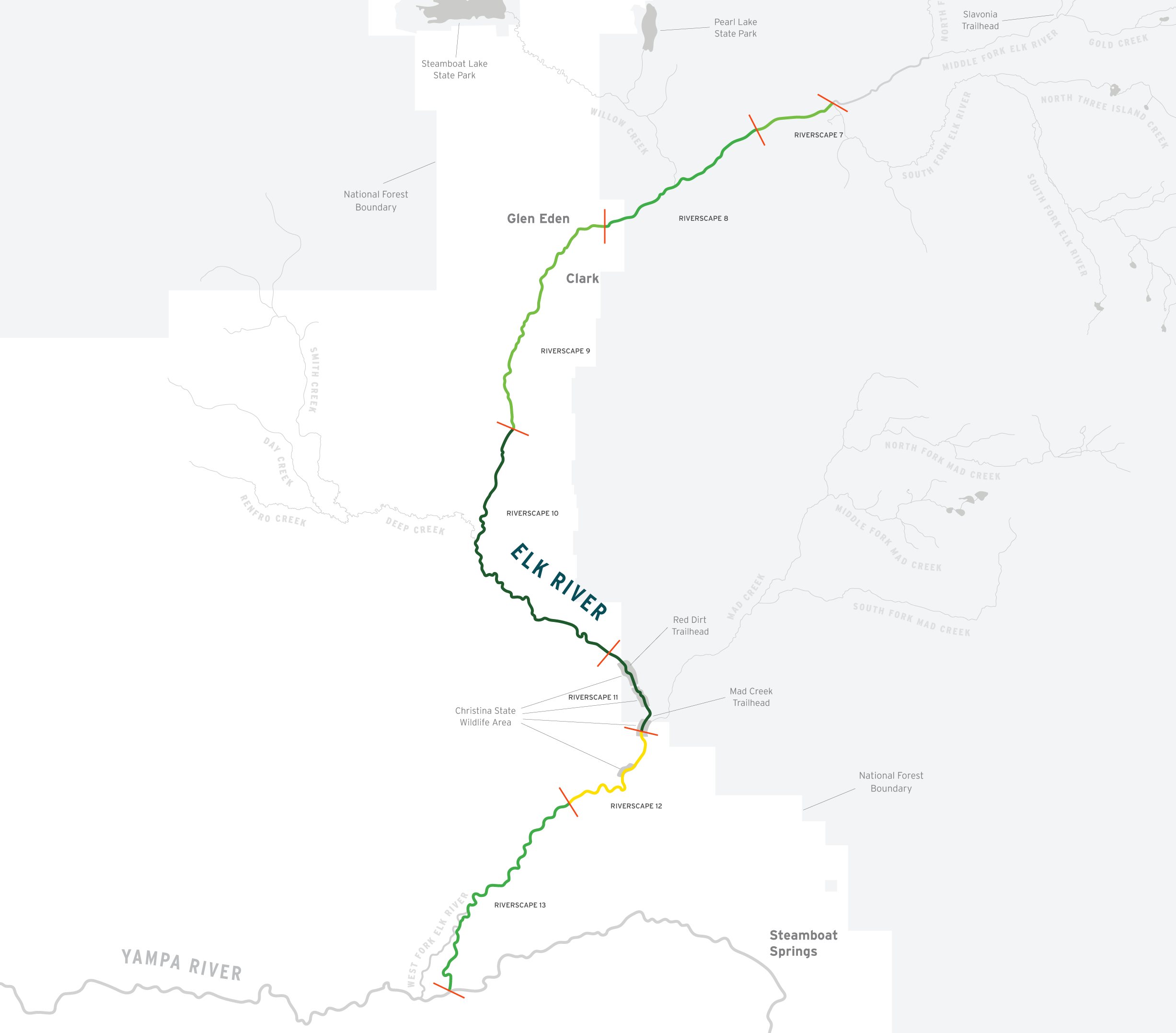
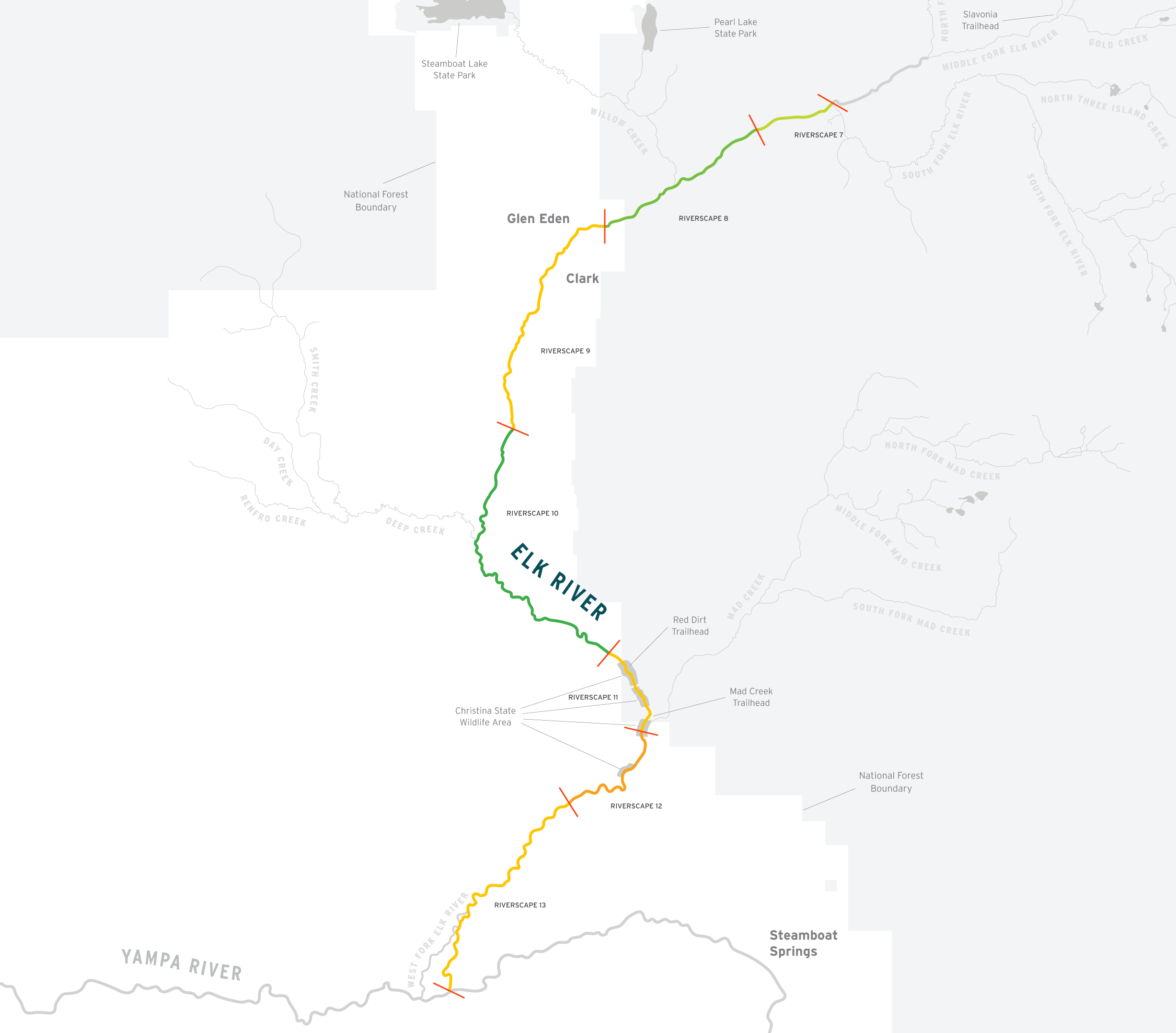
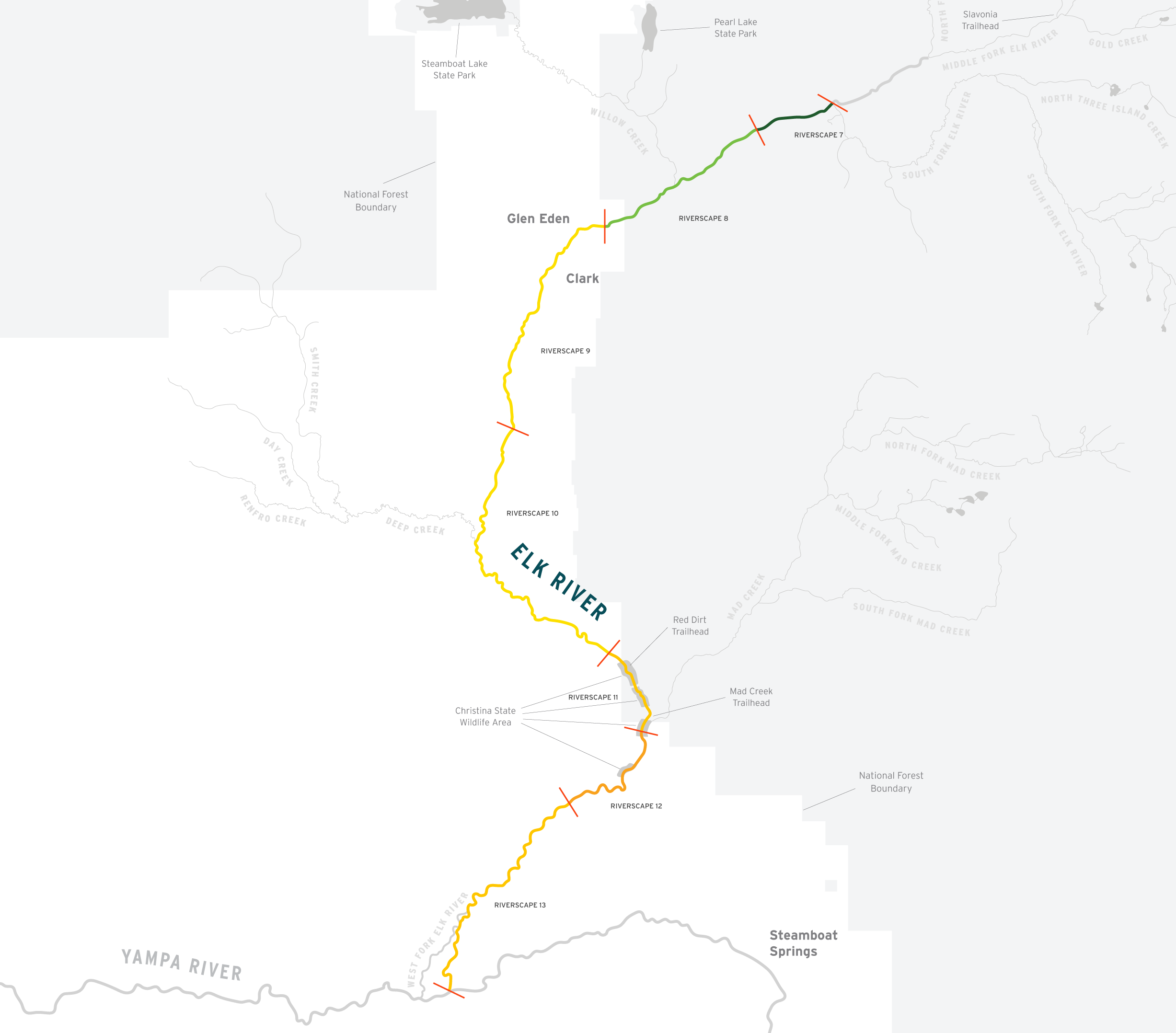
In contrast with other Scorecard segments on the Yampa River, the flow regime in the Elk River remains largely unaltered despite human actions (such as diversions and irrigation withdrawals), contributing significantly to the Elk River segment’s good final score. The overall score of “B” can be credited in large part to past and current protection of the Elk’s natural hydrograph. The undammed Elk carries enormous volumes of water from the Zirkel mountains downstream during spring runoff, helping it to reset and recover annually from environmental stresses and human constraints imposed on the system. However, alterations to the flow regime associated with the changing climate (earlier and more rapid snowmelt and earlier arrival of peak flows) will likely continue over the coming decades and further impact the riverine ecosystem.
———
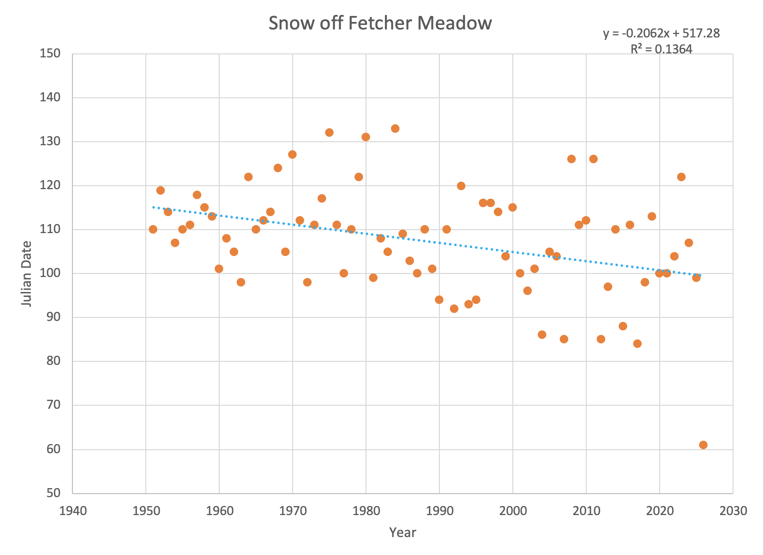
Snowpack:
Jay Fetcher, a longtime rancher in the Elk River valley, and his family have been recording the date that snow melts off of a particular meadow on their ranch since 1951. His data illustrate the wide range of natural variability in the timing of snow melting off of that particular spot, and indicate a (not statistically significant) trend that melt-off has been happening earlier than before. While anecdotal, this type of storytelling and lived experience is critical to understanding conditions on the landscape. They give context to quantitative information and “ground truth” conclusions we make about the data.
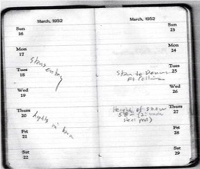
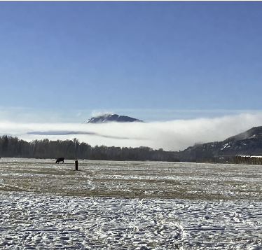
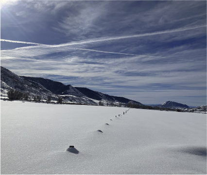
Fetcher meadow photos
Desktop: 3.5.2026 (left) and 3/10/2023 (right)
Mobile: 3.5.2026 (top) and 3/10/2023 (bottom)
Category Score Displayed On Map:
Rivers are naturally dynamic and bank stabilization efforts can often push the problem downstream.
For a deeper understanding of the energy of the river, click on the indicator.
Category Score Displayed On Map:
Category Score Displayed On Map:
Side channels and split flows are commonly found along the Yampa and Elk Rivers and are an important indicator of ecological health. They are calm, slower-flowing areas of water that give fish and other aquatic species a place to rest away from the higher energy water in the main channel. These secondary channels are especially important as spawning grounds and nurseries for native fish species. These river features are considered when assessing both aquatic connectivity and structural complexity of the river.
Category Score Displayed On Map:
The interconnectedness between the Yampa and Elk Rivers and their floodplains mitigates both flood events and drought conditions. When the river swells, its overflow into the floodplain acts as a natural buffer, lessening flood impacts and protecting nearby and downstream communities from erosion and property damage. This overflow also enriches the floodplain soil with nutrient-laden sediments and new seed sources, fostering a diverse plant habitat and contributing to the area’s ecological diversity. Conversely, during droughts, a connected floodplain serves as a natural water reserve. Water stored in floodplain soils slowly seeps back into the river, maintaining flow and supporting aquatic life, especially when water levels are low.
However, in stretches where the river is disconnected from its floodplain, these benefits are notably absent. The lack of overflow during floods leads to more intense and damaging flood events, while during droughts, the absence of a natural water reserve exacerbates low water conditions, harming aquatic ecosystems and leading to concerns about water availability. A disconnected floodplain loses its ability to sustain diverse habitats for wildlife, impacting the river’s biodiversity. It also diminishes the floodplain’s role in filtering pollutants and stabilizing riverbanks, leading to increased environmental stress.
Category Score Displayed On Map:
 Hayfields and riparian areas benefit wildlife. Greater Sandhill Cranes love both riparian wetlands and irrigated hay meadows! The Yampa River (and its tributary, the Elk River) provides abundant wetlands that serve as nesting and roosting areas, and irrigated hay meadows provide food (insects, frogs, and plants) for the omnivorous cranes.
Riparian buffer zones offer a benefit to both hayfields and the river. “Riparian” refers to the area alongside a stream that is planted with native vegetation. When riparian areas exist in between hayfields and the river, they prevent erosion while also intercepting sediment, nutrients, and pesticides before they enter the river. Establishing streamside buffers is also linked to reduced property loss, less downstream flooding, and improved wildlife and pollinator habitat.
*Photo by Sally Thurston
Category Score Displayed On Map:
Channel morphology is not just determined by hydrology and geology, but biology as well!
Plants and animals big and small can actually be drivers of the physical form of a stream (Castro and Thorne, 2019).
For example, riparian vegetation tends to have a stabilizing effect on channel morphology. Beaver change streams by increasing the channel complexity and amount of fine sediment deposition. Amazingly, macroinvertebrates such as caddisfly can be drivers of channel morphology because they reduce the mobility of the sediments along the riverbed. Conversely, macroinvertebrates and fish can also serve to increase bed mobility, due to the disturbance that results when fish forage for a macroinvertebrate meal!
Category Score Displayed On Map:
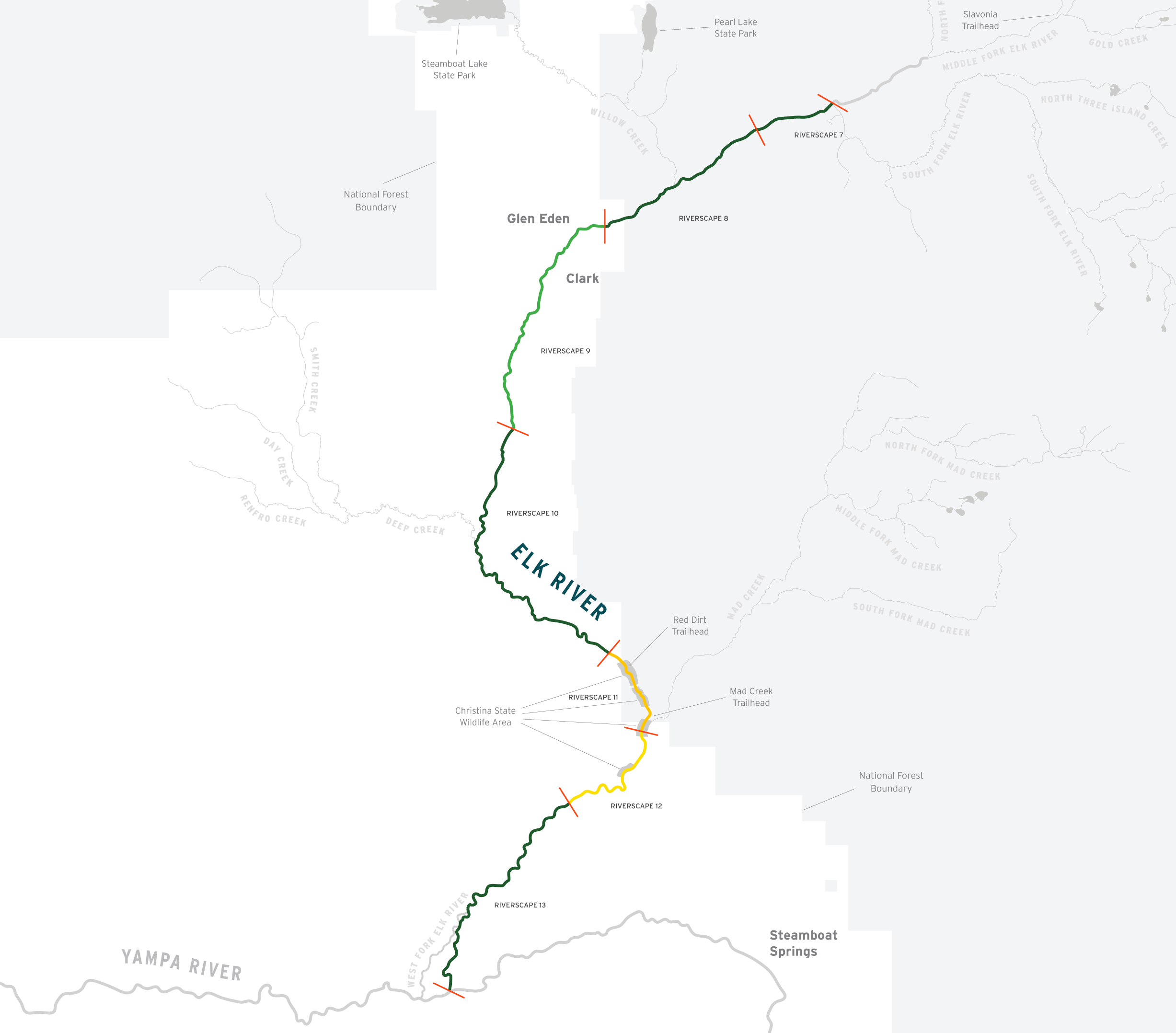
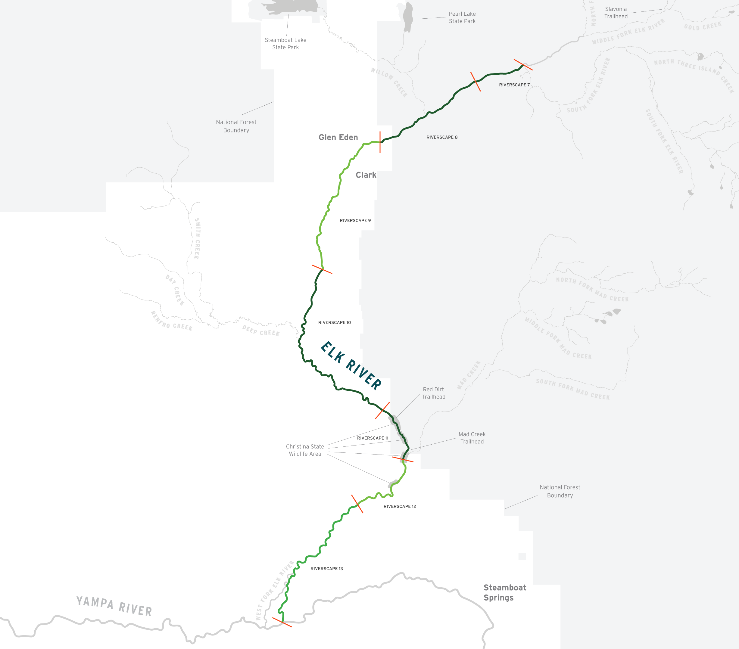
Large wood frequently racks up on the Elk River, creating microhabitats, changing flowpaths, contributing to aquatic habitat complexity, dissipating flow energy, adding organic inputs to the river, and providing many other benefits to the system. These wood jams can also be a major hazard to boaters, so the river should be scouted prior to float activities to prevent trespassing on private property and promote boater safety.
Category Score Displayed On Map:
Macroinvertebrates are amazing little creatures that support a huge food web and can tell us a lot about the water quality of a river. Historically, information on these small animals has been collected irregularly, and there are large gaps in the data set. Through the Yampa River Scorecard Project, Friends of the Yampa is working with local and state partners like Colorado River Watch to fill in the gaps and become a source of ongoing, long-term information about the benthic macroinvertebrate communities in the Yampa and Elk Rivers.
Category Score Displayed On Map:

Yampa River users in the Steamboat segment can launch their trailered craft at River Creek Park near the Walton Creek confluence. While the next boat ramp that allows for the use of a raft trailer at river’s edge is over twenty miles downstream at Hayden Pump Station, the City of Steamboat Springs is moving forward with its plan to install a boat ramp at Bear River Park. Find out more about this exciting addition here.
In the meantime, stay safe and “Know before You Go” using Friends of the Yampa’s website for helpful information related to river recreation.
Category Score Displayed On Map:
It is difficult to measure how agricultural use of water in the river changes over time in a way that is meaningful to the agricultural community. We would like to refine this metric, and are actively soliciting input from community stakeholders. If you have ideas or expertise and would like to help, please contact jenny@friendsoftheyampa.com.
Category Score Displayed On Map:
Water management in the arid western US, “beyond the 100th meridian,” is much different than in the humid east.
The 100th meridian is the longitudinal (north-south) line that divides the arid west from the moist east. West of the 100th meridian, annual rainfall is scarce, and irrigation is required to sustain crops. East of the 100th meridian, abundant water is the norm, average annual precipitation typically exceeds 20 inches, and agricultural lands require no irrigation beyond rainfall. Because of this difference in water availability, two “doctrines” emerged to manage the human use of water.
The Riparian Doctrine
In the eastern US, water use is tied to the land under the Riparian Doctrine, which allows landowners adjacent to the river or stream to divert water for reasonable use. The landowners do not own a water right, but they have a right to use the water for reasonable uses. Because the right to use the water is tied to the land, it is not forfeited if a landowner does not use the water; new reasonable uses can be implemented at any time by the landowners along the waterway.
The Doctrine of Prior Appropriation
The Riparian Doctrine is in direct contrast to the Doctrine of Prior Appropriation, which governs human water use west of the 100th meridian. As settlers of the west faced the reality of water scarcity, this doctrine, also known as “first in time, first in right,” was created to manage the many “straws” pulling from the west’s streams and rivers. Under the Doctrine of Prior Appropriation, the first user to divert water and put it to beneficial use has the senior claim over later water users, regardless of whether their land is adjacent to the river. The most senior water rights holders have first dibs on water use, and users may take water in order of priority until the water is gone. Water rights are not tied to the land, and it is possible that a landowner adjacent to a river or stream would not be permitted to divert water under this system if their water right is junior or if they do not own water rights.
Category Score Displayed On Map:
Colorado Mountain College, Friends of the Yampa, and Colorado State University have teamed up to offer a Yampa River Scorecard Project field course and internship. This field course occurs each June for two weeks. Find out more at https://coloradomtn.edu/classes/, or contact Friends of the Yampa.
Category Score Displayed On Map:
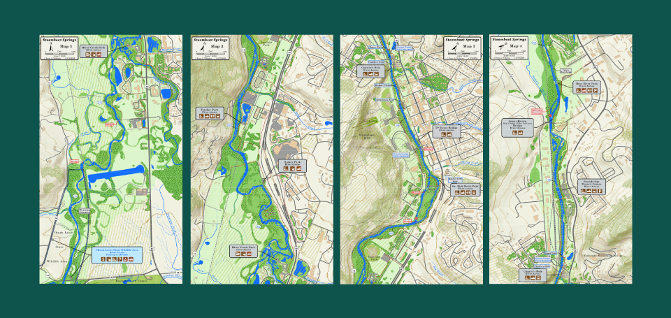
Friends of the Yampa’s Know Before You Go website has helpful river access maps and information to help Yampa River users recreate responsibly and safely.